
This is the furthest bog-shoeing route and the longest, so we plan at least a 5-hour hike and 8-12 km to challenge the limits of your abilities. The landscape stands out with its expanse, where the bog in the form of a small hill rises above the surroundings, not allowing to see the forest on the opposite side. You have to go uphill to see the largest bog lake in the Baltics – Ramatas Lielezers. To get to the swamp, you may have to wade through ditches over felled trees, but it only gives such a hike a real taste.
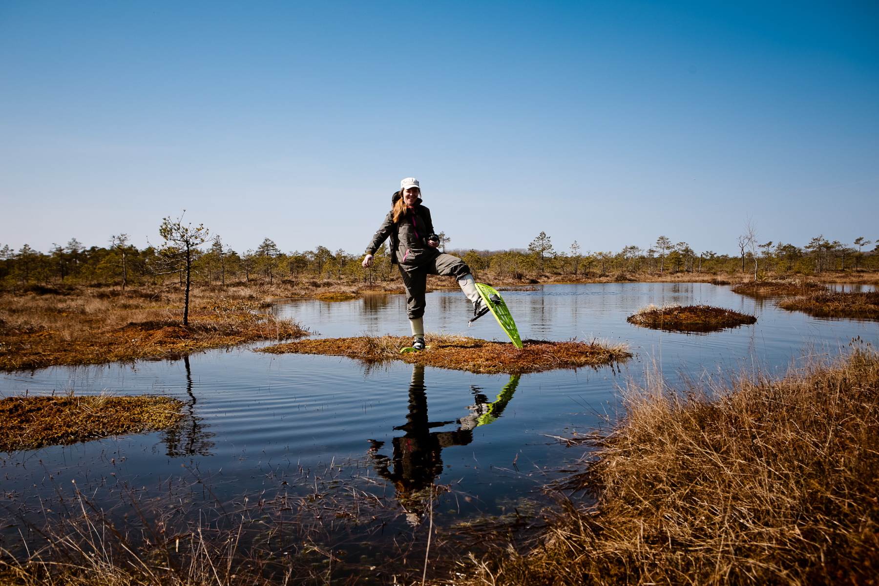
Waterproof shoes (rubber boots) are definitely needed to keep your feet from getting wet before the swamp. If necessary, we can rent rubber boots. And as always – guides will help you discover the secrets of the swamp and the bog-shoes will allow you to get to where it would otherwise be difficult or even impossible. This will also be a great opportunity to collect cranberries, which are now especially delicious.
The hike is intended for active participants who like long hikes and challenges, so they must be in good physical shape and the recommended age of participants is 12-55 years. Age does not matter if you are experienced in hiking.
Description of the hike:
- Duration: 5-6 hours
- Difficulty level: easy-medium (for experienced hikers), medium-difficult (for beginners)
- Length of distance: through the bog with bog shoes ~ 8 km, in total ~ 10 km
- Meeting place and time: at 11:30 in Ramata at the parish administration
- Closing time: around 18:00
- Participation fee for the hike: 20 EUR; 10 EUR (7-17 years). Sign up for the newsletter and receive a 10% discount.
- Bring: snacks and drinking water
- Wear: hiking shoes or rubber boots
- Costs include:
- Preparation of the hiking route
- Delivery and rental of bog shoes
- Many years of experience, knowledge and support of guides
Getting there
By car: click on the link to open the coordinates of the destination in the navigation application, if using waze or google maps, or using coordinates 57.950797, 25.005437
What it looks like in a bog:


* By participating in the hike, you agree to the publication of photos on the social networks of purvubrideji.lv.
* The hiking regulations can be found here.
* The route leads through protected nature areas


